USF researchers demo CREST tool and warn of large historical wetland losses
May 09, 2026 | Sebastian , Indian River County, Florida
This article was created by AI summarizing key points discussed. AI makes mistakes, so for full details and context, please refer to the video of the full meeting. Please report any errors so we can fix them. Report an error »
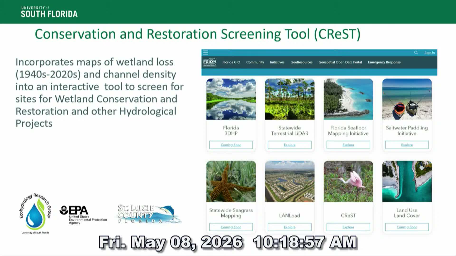
Dr. Kai Raines of the University of South Florida presented an in-depth demonstration of CREST (Conservation and Restoration Screening Tool), a decision-support application that integrates hand-digitized historical survey data, mid‑century aerial mosaics and modern land-cover products to screen the landscape for conservation and restoration opportunities.
Raines described how the team established baselines using 1850s survey maps and 1950s aerial mosaics, then overlaid modern datasets to quantify wetland loss and channelization. He walked the board through CREST’s filter interface — users can screen for conservation priorities (areas with high remaining wetland and imminent development risk) or restoration targets (locations with medium to high channel density and historic wetland loss).
A major strand of the work uses machine learning to extract wetland and map symbology from historical USGS topographic maps and aerial photos; Raines showed a Sebastian topo example where the model successfully recognized intermittent-lake symbology and mangrove markers. Using draft, automated results for Indian River County, Raines reported a preliminary estimate of approximately 64% loss in wetland/lake area over the mapped period, but he emphasized the figure is tentative and will change with further refinement.
Raines said the current funding supports the historical mapping phase but not full CREST deployment. He asked the board and partners for letters of support and noted potential enhancements — for example, adding a sea-level-rise/flooding module — that depend on additional funding. He acknowledged graduate students and collaborators responsible for the automated mapping and invited follow-up conversations with county staff and technical partners.
Board members asked about validation processes and how CREST outputs would be used in local planning; Raines said CREST is exportable (ArcGIS Online format and common data exports) and is intended to help prioritize parcels for conservation easements, restoration, or further field assessment. The board agreed to consider partner letters that would help secure funding to complete the tool’s development.
View the Full Meeting & All Its Details
This article offers just a summary. Unlock complete video, transcripts, and insights as a Founder Member.
✓
Watch full, unedited meeting videos
✓
Search every word spoken in unlimited transcripts
✓
AI summaries & real-time alerts (all government levels)
✓
Permanent access to expanding government content
30-day money-back guarantee
