Teams consolidate statewide sewage-service boundaries and addresses but note gaps in permits and addresses
February 02, 2026 | State Water Resources Control Board, Agencies under Office of the Governor, Executive, California
This article was created by AI summarizing key points discussed. AI makes mistakes, so for full details and context, please refer to the video of the full meeting. Please report any errors so we can fix them. Report an error »
The advisory group reviewed the project's spatial-mapping work to attribute populations and community characteristics to wastewater systems and facilities.
Dan Coffey and Greg Pierce described a multi-source consolidation approach: where available, collection-system shapefiles (service-area polygons) will be used to attribute climate and socioeconomic data; where polygons are not available, the team will use facility points/addresses and consider drawing buffers (sized by flow or population) or matching to governing jurisdictions.
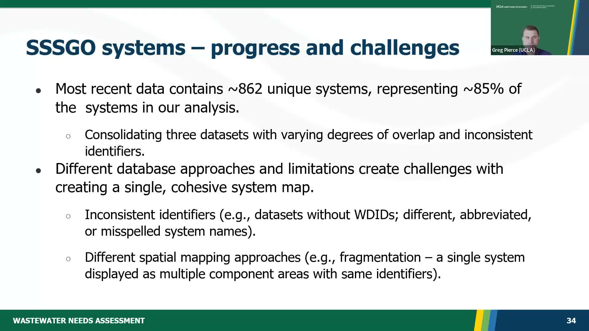
Status and coverage: Dan Coffey said the combined dataset currently contains about 862 unique collection systems representing roughly 85% of systems in the state after the December 31 data deadline. He warned of nontrivial consolidation work: "Different approaches have used identifiers inconsistently," Coffey said, citing misspellings, abbreviations, fragmented polygons and inconsistent identifiers across source datasets that require manual reconciliation.
Address challenges: leads said some WDR facilities list PO boxes or have incomplete addresses and that the team has manually reviewed several hundred facilities using online mapping to resolve many of these, but a small number remain unresolved. The team will contact regional boards for cases where public records fail to yield a confident location.
Implications for analysis: project staff stressed mapping will not be used to change inadequacy flags but is essential for risk-variable attribution (environmental and socioeconomic indicators), solution identification and costing. Members suggested parcel datasets, sewer-management plans, permit addresses and city boundaries as useful supplementary sources.
Next steps: staff will continue consolidation, apply rules to minimize redundant overlapping areas without losing coverage, and will invite regional boards to flag obvious location errors in the review worksheets.
Dan Coffey and Greg Pierce described a multi-source consolidation approach: where available, collection-system shapefiles (service-area polygons) will be used to attribute climate and socioeconomic data; where polygons are not available, the team will use facility points/addresses and consider drawing buffers (sized by flow or population) or matching to governing jurisdictions.
Status and coverage: Dan Coffey said the combined dataset currently contains about 862 unique collection systems representing roughly 85% of systems in the state after the December 31 data deadline. He warned of nontrivial consolidation work: "Different approaches have used identifiers inconsistently," Coffey said, citing misspellings, abbreviations, fragmented polygons and inconsistent identifiers across source datasets that require manual reconciliation.
Address challenges: leads said some WDR facilities list PO boxes or have incomplete addresses and that the team has manually reviewed several hundred facilities using online mapping to resolve many of these, but a small number remain unresolved. The team will contact regional boards for cases where public records fail to yield a confident location.
Implications for analysis: project staff stressed mapping will not be used to change inadequacy flags but is essential for risk-variable attribution (environmental and socioeconomic indicators), solution identification and costing. Members suggested parcel datasets, sewer-management plans, permit addresses and city boundaries as useful supplementary sources.
Next steps: staff will continue consolidation, apply rules to minimize redundant overlapping areas without losing coverage, and will invite regional boards to flag obvious location errors in the review worksheets.
View the Full Meeting & All Its Details
This article offers just a summary. Unlock complete video, transcripts, and insights as a Founder Member.
✓
Watch full, unedited meeting videos
✓
Search every word spoken in unlimited transcripts
✓
AI summaries & real-time alerts (all government levels)
✓
Permanent access to expanding government content
30-day money-back guarantee
