Fruit Heights council briefed on HB48 requirements for wildland-urban interface overlay and possible property assessments
January 08, 2026 | Fruit Heights City Council, Fruit Heights, Davis County, Utah
This article was created by AI summarizing key points discussed. AI makes mistakes, so for full details and context, please refer to the video of the full meeting. Please report any errors so we can fix them. Report an error »
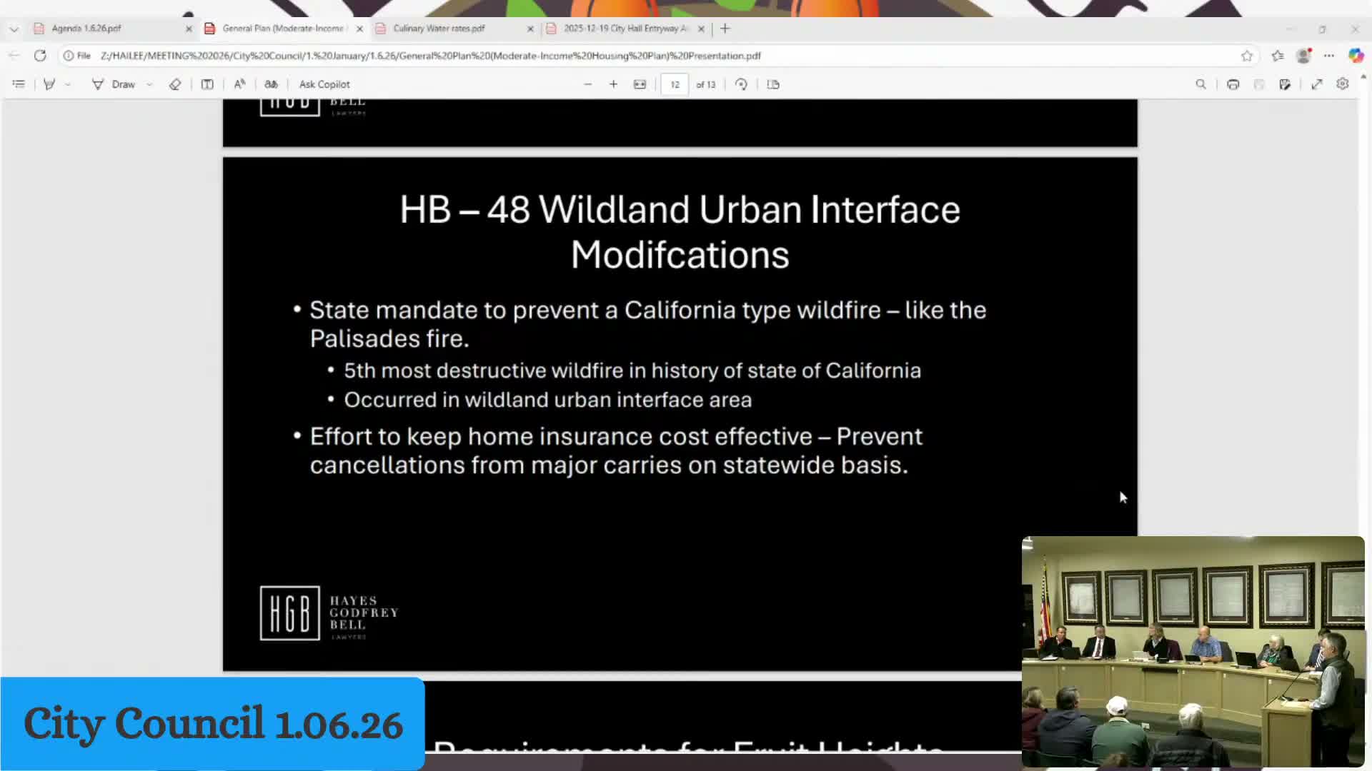
City attorney Brad Christopherson told the council that House Bill 48 requires the state to identify high-risk wildland–urban interface (WUI) zones and directs cities to adopt an overlay zone and the state's WUI building code. He said Fruit Heights recently received the state map and must adopt an overlay and related building-code ordinance, which will be reviewed by the planning commission before coming to council.
Christopherson said the overlay will identify structures with elevated fire-risk scores; properties that meet a certain risk threshold could be assessed an annual fee added to property tax bills to pay for mitigation. He said the state will determine the fee amount and that properties in the overlay must meet new standards for materials, setbacks, vegetation clearance and defensible space (he described a typical clear-space requirement on the order of 20–25 feet from structures for brush removal).
Council members asked whether homeowners could remove brush themselves and whether the city would be charged for city-owned structures; Christopherson said owners may clear brush and that fees apply to owners of affected structures (the city would only be assessed if the city itself owned structures within the overlay). He recommended the city act as “a good neighbor” in clearing city property where appropriate and said more detailed guidance will come from the building-code specialist and the planning commission review.
Staff noted the overlay likely covers east-side areas with dense vegetation and that the planning commission will review specific ordinance language and maps. Christopherson said adopting the overlay and code is tied to eligibility for preparedness, prevention and mitigation funds; failure to adopt could make the city ineligible for some state programs.
Next steps: staff will present the state map and proposed overlay and ordinance language to the planning commission and bring the item back to council for public hearing and decision.
Don't Miss a Word: See the Full Meeting!
Go beyond summaries. Unlock every video, transcript, and key insight with a Founder Membership.
✓
Get instant access to full meeting videos
✓
Search and clip any phrase from complete transcripts
✓
Receive AI-powered summaries & custom alerts
✓
Enjoy lifetime, unrestricted access to government data
30-day money-back guarantee
