Louisiana officials project $777 million in flood losses by 2050 without updated regulations
December 10, 2024 | Amite River Basin Drainage and Water Conservation District, Boards & Commissions, Organizations, Executive, Louisiana
This article was created by AI summarizing key points discussed. AI makes mistakes, so for full details and context, please refer to the video of the full meeting. Please report any errors so we can fix them. Report an error »
On December 10, 2024, the Amite River Basin Drainage meeting focused on critical updates regarding flood management and infrastructure improvements in Louisiana. The discussions highlighted the importance of freeboard regulations and the potential economic impacts of flooding in the region.
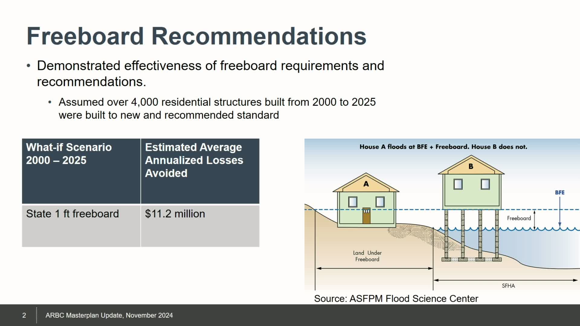
One of the key topics was the implementation of a one-foot freeboard requirement for new residential structures, a measure that aims to elevate buildings above potential flood levels. This regulation, championed by Commissioner O'Neill, has shown promising results. A hypothetical analysis indicated that had this requirement been in place since 2000, the community could have avoided approximately $11.2 million in annualized losses due to flooding. This underscores the significant benefits of proactive flood management strategies.
The meeting also addressed the ongoing erosion and sedimentation issues affecting the Amite River. Presenters shared visual data illustrating over 50 years of erosion, revealing substantial changes to the river's landscape. Projections for 2050 suggest that sedimentation could increase by one to seven feet in various areas, which could exacerbate flooding risks. The discussion included the implications of changing rainfall patterns, urbanization, and sea level rise, with estimates indicating that nearly 8,000 additional structures could fall within flood zones by 2050 if current trends continue.
Furthermore, the meeting explored the potential for updating FEMA flood maps using advanced data from the Louisiana Watershed Initiative. Current FEMA maps are based on outdated information, while new lidar technology provides much more accurate elevation data. This update could lead to the removal of thousands of structures from flood hazard areas, particularly in Livingston Parish, where many buildings are situated on higher ground.
In conclusion, the Amite River Basin Drainage meeting highlighted the urgent need for updated flood management practices and infrastructure improvements. The discussions emphasized the importance of using modern data to inform decisions, which could significantly reduce flood risks and economic losses in the region. As the community prepares for future challenges, the insights gained from this meeting will be crucial in shaping effective flood mitigation strategies.
Don't Miss a Word: See the Full Meeting!
Go beyond summaries. Unlock every video, transcript, and key insight with a Founder Membership.
✓
Get instant access to full meeting videos
✓
Search and clip any phrase from complete transcripts
✓
Receive AI-powered summaries & custom alerts
✓
Enjoy lifetime, unrestricted access to government data
30-day money-back guarantee
