Wildfire safety progress map reveals crucial updates
June 11, 2024 | Tuolumne County, California
This article was created by AI summarizing key points discussed. AI makes mistakes, so for full details and context, please refer to the video of the full meeting. Please report any errors so we can fix them. Report an error »
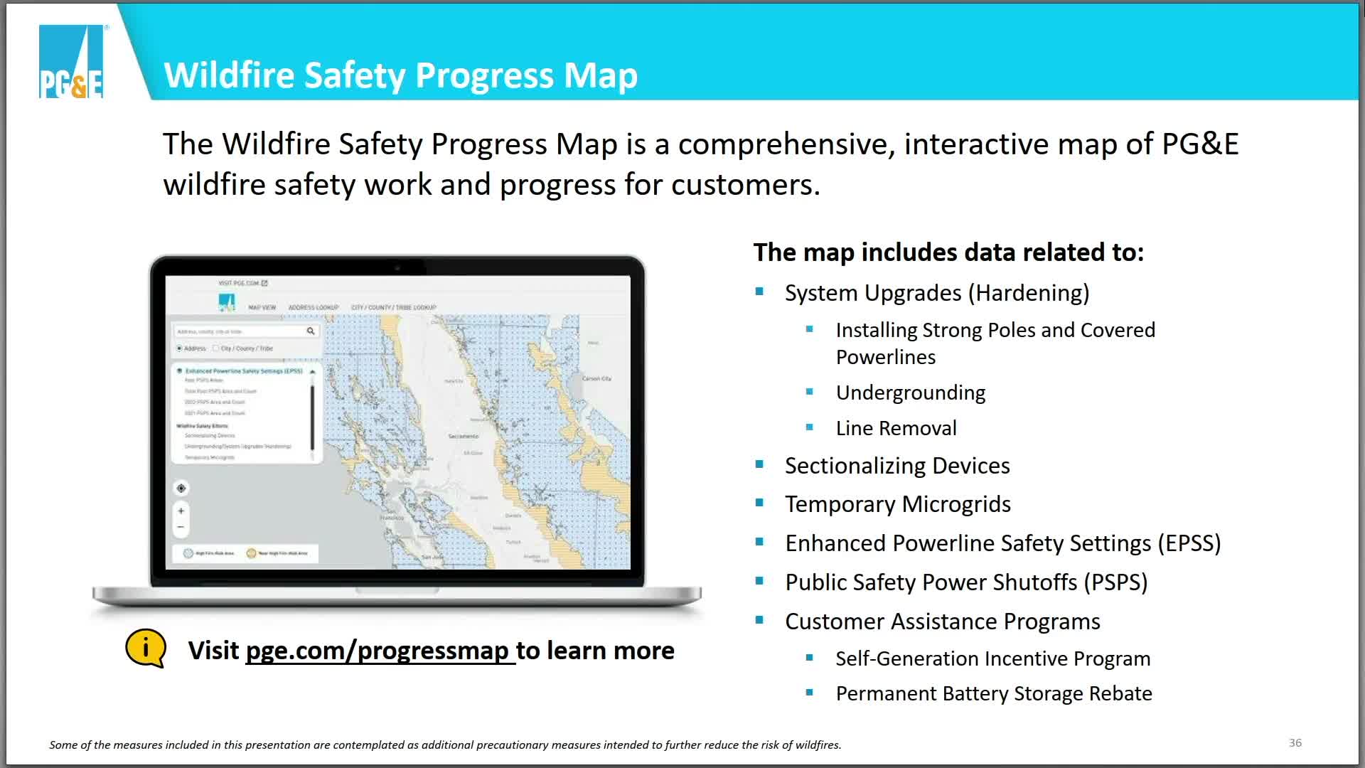
During a recent government meeting, officials emphasized the importance of public access to resources regarding wildfire safety and mitigation efforts. A key highlight was the introduction of a new wildfire safety progress map, designed to inform residents about ongoing and future initiatives in their areas.
Officials noted that one of the most frequently asked questions from the community is about specific actions taken to enhance safety against wildfires. The progress map serves as a comprehensive tool, allowing residents to view detailed information on various safety measures, including fire hardening techniques, undergrounding efforts, and the implementation of essential devices such as microgrids and Enhanced Power Safety Settings (EPSS).
The meeting underscored the commitment to transparency and community engagement, encouraging residents to utilize these resources to stay informed about local wildfire safety initiatives.
Don't Miss a Word: See the Full Meeting!
Go beyond summaries. Unlock every video, transcript, and key insight with a Founder Membership.
✓
Get instant access to full meeting videos
✓
Search and clip any phrase from complete transcripts
✓
Receive AI-powered summaries & custom alerts
✓
Enjoy lifetime, unrestricted access to government data
30-day money-back guarantee
